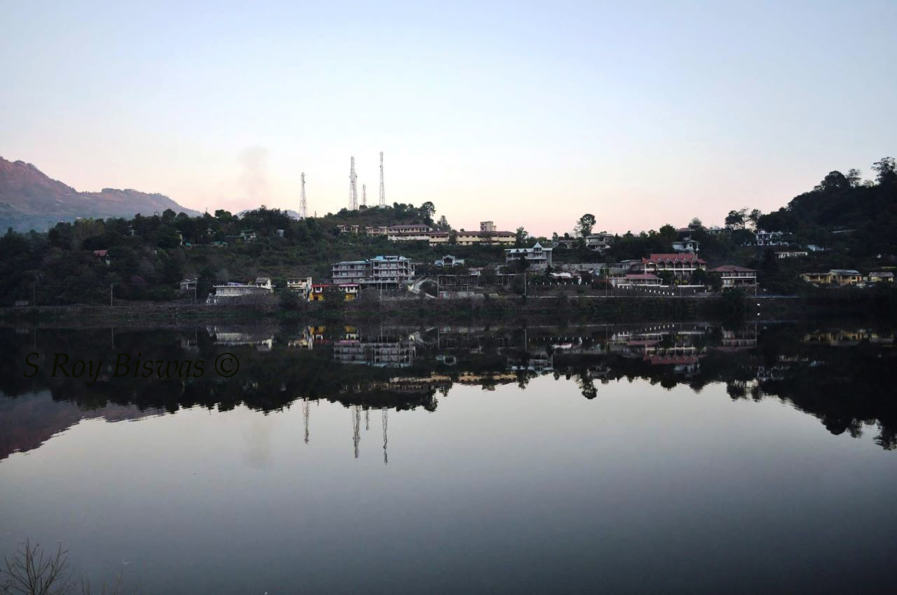
Bhimtal is the biggest lake in the Nainital district of
Uttarakhand. This lake has been in
existence since ancient times, being a gateway to the plains below for people
moving in from present day Pithoragarh and Tibet etc. for trade during historic
times. It was discovered by the British
only in 1841 and developed to some extent by them. Folklore of the region say that the Pandavas
had visited the place and Draupadi was thirsty, so Bhima struck the ground and
water flowed forth in this place that formed a lake and since then the water
continues of replenish the lake perennially, thus, the lake is named after him
as Bhimtal. An ancient Shiva temple,
known as ‘Bhimeshwara Mahadev’ temple is also located in Bhimtal, which as per
folklore is touted to have been built by Bhima and has been standing there
since centuries. The present temple was
renovated in the 17th Century A.D by Kumaon King Baz Bahadur of
Chand dynasty.
Bird's eye view of Bhimtal - all buildings cramping up the place
Panoramic view of Bhimtal lake
As the clouds envelope Bhimtal lake during monsoon
Another view of Bhimtal lake during monsoon
Geographically, Bhimtal is located about 22 Kms. from
Nainital and about 20 Kms. from the last railhead Kathgodam. It is perched at an altitude of 1370 meters
and enjoys a salubrious climate the year round.
Bhimtal is situated at the base
of Karkotaka mountain, named after the famed mythological Snake. At present Bhimtal has become a hub of
housing activity all across this mountain, with several individual and
apartments coming up in the region. The
tourists get to enjoy boat ride in the lake and also angling facility. During the recent past the adventure of para
gliding has also been added in the list of activities that the tourists can
enjoy. The STD Code for Bhimtal is – 05942
and the Pin Code of Bhimtal is – 263136.
Panoramic view of Kosi River meeting Khairna River at Khairna
Having described
Tarikhet in my previous blog, as I reiterate my steps back towards Kathgodam
from my village Badankhet in Tarikhet Block in Ranikhet Tehsil of Almora
District in Uttarakhad in Kumaon region of the State, one passes through the
junction of Ganiadholi, wherefrom the road bifurcates towards Ranikhet and
Tarikhet.Thereafter, as one heads away
from Ranikhet, one comes across villages like Pilkholi, known to the travellers
where one can buy traditional Kumaoni sweets like Choclate (a milk based
product), Bal Mithai and Singhori (remaining ones too be milk based
sweets).Thereafter, across the twenty
three kilometres journey from Tarikhet to Khairna one passes by many other
villages perched by the roadside in the following sequence - Bajol – Bhujan –
Majhera.Thereafter, one crosses the
bridge across Kosi River and turn right towards Kharina and the other road from
here, towards the left hand side, heads
towards Almora.Thus, Khairna (PIN Code
– 263135/STD Code – 05942) is also basically a junction point, wherefrom the
road bifurcates towards Ranikhet and Almora.
Ganiadholi - wherefrom road bifurcates towards Ranikhet & Tarikhet
A panoramic view of villages perched on the road from Ranikhet to Khairna
Khairna is also a
market township that caters to the needs of the villages all around it that are
situated on the road towards Betalghat and other villages of Naintial district
around it.Earlier, the two destinations
of Khairna and thereafter, Garam Pani were distinct and separate, but over the
years, with the spread of the market area along the highway, the distinction
has all but faded.There is a Petrol
pump situated in this quaint village town, being bang on the National Highway
109.Khairna is situated on the
confluence of the Kosi and Khairna Rivers, the first one flowing from Almora
side and the second one from Nainital side.Khairna is thus, placed in the valley perched in between mountains at an
altitude of 913.34 meters i.e. about 2996.51 feet above mean sea level
(MSL).Therefore, during the day time in
summers it is considerably hot and heat is modest during the nights.However, during winters it is quite cold but
not totally unpleasant.
Khairna by night - shot taken from KMVN, Khairna
A Crested Kingfisher in Kosi River - early morning shot
View of TRH at Khairna managed by KMVN - sourced from internet
There are no distinct
travel landmarks in Khairna, but can be used as a transit point while
travelling to distant destinations in the Kumaon region.Although fishing is prohibited, but one can
enjoy feeding the fishes by going down the stairs of the KMVN managed Tourist
Rest House in Khairna, which also offers a restaurant as well as rooms to stay
for the tourists/visitors.The freshly
cooked food in this restaurant has always been my favourite and whenever, I
traverse through this part, especially when travelling by train upto Kathgodam,
I stop here for either lunch or snacks and never had any complaint regarding
the quality of food.Various aquatic
birds can also be spotted in this region, especially early in the mornings and
hence a short stopover for birders is also advisable.So next time you are in Kumaon, remember this
quaint nondescript destination.


