Pages

Saturday, September 21, 2013

Ladakh - Visiting Tso Moriri (a photo essay)

Ladakh – the moonland of Monasteries
(Visiting Tso Moriri)
 
Panoramic view of Tso Moriri
The weather was inclement since the last few days and after arrival, we have had to tweak our original itinerary.  Except for the first day, when we had visited places around Leh, the weather had been bad especially during our outing to Lamayuru etc. and as we had not been able to obtain the inner line permits and 16th June, 2013 being a Sunday, we had lazed around at Leh itself, as our plan to visit Tso Moriri had not materialized.  We started early at around 6.30 A.M. on 17th June, 2013, as we had received a hand written permission from a senior Police Officer and our first choice was to visit Pangong Lake, weather permitting, alternatively to visit Tso Moriri and after overnight stay, return the next day, after visiting Tso Kar and returning via Tanglangla & Sarchu to Leh.  However, as soon as we reached Karu, bad news awaited us.  The snowfall on 16th June & ensuing night of 17th June, 2013 had blocked Changla pass completely and there was little chance of its opening during the first half of the day.  Thus, we had no other alternative, but to proceed towards Tso Moriri.  However, after crossing Karu and having traveled only a few kilometers further ahead, a huge traffic jam awaited us at Upshi and we found out that the overnight snowfall had blocked the Tanglangla Pass and other passes on the Manali-Leh highway as well and no vehicles proceeding towards Manali, were being allowed to proceed any further beyond Upshi.  The little jotting of the Police Officer, in our custody, did the trick for us and we were cleared in no time to proceed ahead.
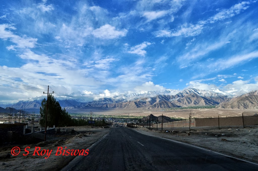
Early morning - view from road near Choglamsar
At Karu - the road from here bi-furcates towards Manali/Tso Moriri & Pangong Tso
Headed towards Tso Moriri - the weather is inclement
         There are a few variations to the above listed circuit, one can either go to Tso Moriri or do the entire Tso Moriri – Tso Kar circuit and come back to Leh via the same route or via the Manali – Leh highway.  As we traveled, the sky which was already overcast started assuming darker hues, with occasional short spurts of showers.  The total distance from Leh to Tso Moriri via Mahe is about 215 Kms.  Upshi is about 55 Kms. from Leh, a small village with a checkpost, where the inner line permits are checked, but as stated above, the little note did the trick for us.  Further ahead lies Chumathang, about 95 kms from Leh and for the better part of this stretch of journey beyond Upshi, we had the Sindhu/Indus River for company.   En-route one crosses Kumdok which is a military establishment and I did not photograph the place.  Chumathang itself has little to offer to a visitor apart from a few restaurants, a Gompa and hot water springs. A quick lunch stop would suffice for most, but I found many of the travelers heading for the hot springs, around which a lot of artificial structures have come up and was least appealing to me and thus, I preferred to press ahead, rather than waste my valuable time there.  The distance from Chumathang to Tso Moriri (Korzok) is about 60 kms. At a distance of about 22 Kms. from Chumathang is Mahe, which is another checkpoint and we had to present our magic chit to get past.  The road bifurcates from Mahe, to head for Tso Moriri one has to cross the bridge across the Sindhu/Indus River and the road straight down heads towards Nayoma, Loma to Hanle.  From Mahe it is a relatively easy drive till Puga Sumdo village, wherefrom the road towards Tso Kar & Manali bifurcates.  After traveling a few kilometers further ahead, you cross across a small metal bridge, laid across a narrow stream and reach a small remote settlement known as Polo Kongkha La, where we saw some nomadic tents and a few houses with Yaks grazing nearby.  After crossing this point, it is best not to use the road any longer, as no bitumen is left on the road surface and the rocky base is exposed and it is too bumpy, instead either make your own track by driving/riding off road or use one of the numerous tracks left by passing vehicles.  On way to Tso Moriri we came across a small but beautiful lake known as ‘Tso Kiagar’, but we did not venture out, as the weather had taken a turn for the worse and it had started snowing, albeit in the month of June !!!
Spot the Chukor - a local bird perfectly camouflaged in the background
The Sindhu/Indus River valley - panoramic view on way to Tso Moriri
The meandering Sindh/Indus River - another panoramic view of the river valley on way to Tso Moriri
The racing Marmot - wildlife galore on way to Tso Moriri
Güldenstädt's Redstart - shot on way to Tso Moriri
Yellow billed Chough
Pika - it is not a rodent but a mammal
            Tso Moriri, ‘Tso’ means ‘Lake’ and ‘moriri’ means ‘mountain’, which literally translates to ‘Lake of the mountains’ and is officially called ‘Tso Moriri Wetland Conservation Reserve’.  It is a alpine lake in the Changthang, which literally means ‘northern plains’, is an area in Ladakh. The lake is at an altitude of 4,595 m (15,075 ft) and it is the largest amongst the high altitude lakes in the Trans-Himalayan region, entirely within India.  The lake is fed by springs and snow-melt from mountains on the Changthang plateau. Water enters the lake in two major stream systems, one entering the lake from the north, the other from the southwest.  Both stream systems create extensive marshes where they enter the lake. It formerly had an outlet to the south, but this has become blocked and the lake has become land locked. As a result, the water is now becoming saline. The other smaller lake i.e. Tso Kar lake was a source of salt for local people until late fifties, this is reflected in the lake's name, ‘Tso Kar’ literally means ‘salty lake’ in local language.  Both the lakes are ‘Oligotrophic’ in nature, and its waters are alkaline.
View of Sindhu/Indus River from Mahe Bridge
Puga Sudoh village - Road bifurcates towards Tso Kar/Manali from this village
It has started snowing - upper hills already covered with snow on way to Tso Moriri
Tso Kiagar - another lake just before reaching Tso Moriri
Yaks in the snow - on way to Tso Moriri
A snow bouquet for you - near Tso Moriri 
         Even though Tso Moriri is smaller than Pangong Tso and fewer people come here, it is more beautiful in some ways due to the fact that area surrounding Tso Moriri is a wild life reserve and one can see Tibetan wild ass (Kiang), marmots, red foxes and quite a few migratory birds. I had also planned this destination for photographing some of these in the wilderness.  But as we proceeded further, heading for Korzok the snowfall kept on increasing in its intensity.  Before reaching Tso Moriri there is another small lake known as Tso Kiagar, which is also quite a big lake with aquatic birds in it, but as we were getting late coupled with the fact that the weather had taken a turn for the worse, we decided to take a break at the lake during our return journey, next day.  Just before one enters Korzok, another check-post manned by ITBP personnel is to be crossed.  The personnel on Sentry duty here refused to honor the so called ‘magic chit’ that had cleared all the barricades so far.  I gave him my introduction and showed him my official card and honoring his commitment towards duty, asked him for only leverage to allow the kids some food at Korzok, by keeping my Government Identity Card as guarantee, to redeem the same on my return, as the kids had nothing since morning.  I further added that in case it was beyond his competency, he should take me to the office of his ‘Commanding Officer’ and if granted an audience and permission, I would proceed or else return back,  but his attitude was outright dirty and unbecoming of a Government servant.  Apparently, in such remote places, the Sentry duty sepoy holds the rights of visitations/schedules of his Officers and such apathy for an Officer, visiting part of his own country!!!  It is really sad state of affairs so far as ITBP is concerned.  I had to return back from gates of Tso Moriri.  For accommodation and eateries, one has to take the right turn from the main entrance of Tso Moriri wild life sanctuary and continue for few kilometers to reach the village of Korzok a.k.a. Karzok.
Panoramic view of Tso Moriri from the other side
Bar-headed Geese in Tso Moriri 
Snow flakes all around - a Tern in Tso Moriri
Another of the famed Bar-headed geese in Tso Moriri
Our taxi driver in Ladakh - a fine fellow - Tashi in snow in Tso Moriri
On the return leg - the landscape is now completely covered in snow - a lone yak grazing 
Difficult living conditions - hut to a nomad at Tso Moriri almost covered in snow
A few brave men - foreign cyclists headed for Tso Moriri in snowfall- as we head back to Leh
Famished - having noodles in far flung Mahe in a small shop
        On the hind sight, I believe that it was all God’s providence that we had to turn back from Tso Moriri, as within a span of an hour, during our return leg, we found that the snowfall had intensified into a blizzard and the dirt tracks were all but being gradually covered up by snow and in case of overnight halt, it could have turned calamitous.  As I have already pointed out that there are very few visitors to this destination and coupled with this, in case of heavy snow, all the tracks would have disappeared and it would have become very difficult to drive back.  However, despite the drawback, I did not lose heart and made most of the situation by taking shots of rare Bar headed geese and terns etc.  The distance from Tso Moriri (Korzok) to Tso Kar is about 80 kms. and the area surrounding Tso Kar is protected and forms the Tso Kar wild life sanctuary.  We retraced our steps back till Mahe and had our lunch of Noodles & tea there, perfectly cooked by the petite lady shopkeeper, before returning back to Leh late in the evening and thus, ended our trip to Tso Moriri.

Here is the link to my video for the destination -

Saturday, September 14, 2013

Ladakh - Visiting Lamayuru Monastery


Ladakh – the moonland of Monasteries
(Visiting Lamayuru Monastery)
Panoramic view of valley below from Lamayuru Monastery
By the time we hit the main highway again from Alchi, the rainfall had again intensified.  The road was now running along the Sindhu River through a narrow canyon like hill and we started ascending towards Lamayuru. Lamayuru or Yuru Gompa  is a Buddhist Gompa  (monastery) in Kargil District, Western Ladakh, India, situated on the Srinagar - Kargil - Leh road 15 km east of the Fotu-La, about 127 Kms. from Leh.  Lamayuru Monastery is situated in between Bodhkharbu and Kha-la-che, on a steep rock mountain at a height of 3,510 meters.  The monastery is made up of a number of shrines and also has a very rich collection of thangkas and magnificent wall paintings. At the outset, the Lamayuru Monastery consisted of five buildings, out of which only the central one exists today.  Lamayuru Monastery belongs to the Red-Hat sect of Buddhism and houses approximately 150 Buddhist monks. 
Entering the National Highway to Srinagar on way back from Alchi
The weather deteriorates further as we head towards Lamayuru
Passing by Khalste - we stopped here for lunch on our way back from Lamayuru
As we head higher towards Lamayuru - Sindhu Rivers appears to be only a rivulet
            It was originally the foremost Bonpo monastery in Ladakh and was called gYung-drung Monastery (from Tibetan: gYung-drung - a swastika - a popular symbol in Bon, Buddhism, and other religions); also gYung-drung-bon is the name of the Bon religion.   As per the legends, the Indian scholar Mahasiddhacarya Naropa (956-1041 CE), allegedly caused a lake which filled the valley to dry up and founded Lamayuru Monastery. The detailed legend states that he Lamayuru Valley used to be a clear lake, at the time of Sakyamuni (the Historical Buddha) and, nags (holy serpents) used to reside in the lake. Bodhisattva Madhyantaka had once a prediction quite a long time back that the lake would eventually be dried, making way for the construction of a Buddhist monastery. The legend moves further to state that Mahasiddhacharya Naropa, an 11th century Indian Buddhist scholar, sat in meditation for a number of years in one of the caves in Dukhang. He was the one who caused a crack in the hillside surrounding the lake.  Through this crack, the lake started draining. When the lake dried out, the scholar found a dead lion lying inside it. On the same spot, where he found the lion, he constructed the first temple of the area, known as the Singhe Ghang (Lion Mound). Another legend has it that the building of Lamayuru Monastery was constructed, as per the instructions of King of Ladakh, under the direction of Rinchen Zangpo, the Translator. After this, the monastery came under the administration of the Zhwa-mar-pa (Red Hats).  The oldest surviving building at Lamayuru is a temple called Seng-ge-sgang, at the southern end of the Lamayuru rock, which is attributed to the famous builder-monk Rinchen Zangpo (958-1055 CE). 
Mud hills on way to Lamayuru
Entry point to Lamayuru Monastery below - view of Monastery precincts
The Chorten inside the Lamayuru monastery complex
The green valley below Lamayuru Monastery
The monks' residence atop hill in Lamayuru
Typical mud construction - check out the thickness of the walls at Lamayuru Monastery
             The oldest gompas, those dating from Rinchen Zangpo's time —  Alchi and Lamayuru, and the less accessible Wanla, Mang-gyu and Sumda — belonged at the time of their foundation to none of these Tibetan schools, whose establishment they antedate. They were at some stage taken over by the Ka-dam-pa, and when it fell into decline they were taken over again, this time mostly by the Ge-lugs-pa. The exception was Lamayuru, which was for some reason claimed by the Dri-gung-pa.  The gompa consisted originally of five buildings, and some remains of the four corner buildings can still be seen.  Lamayuru is host to two annual masked dance festivals, in the second and fifth months of the Tibetan lunar calendar, when all the monks from these surrounding gompas gather together to pray. 
Tangkhas inside Lamayuru Monastery
Tangkhas inside Lamayuru Monastery-1
Tangkhas inside Lamayuru Monastery - newer versions
The lady monks of Lamayuru monastery entering the prayer hall
The monk's hostel and meditation halls - atop a hillock in Lamayuru
The bird that brings luck - Black billed Magpie a common bird in Ladakh
On the day we visited Lamayuru, preparations were on way for impending arrival of a senior & honoured Lama.  By the time we had gone around the monastery, the rainfall had taken another short breather and on our return journey, we took the opportunity to take a short break for lunch at Khalse or as the road sign read ‘Khaltsi’ at the ‘Samyas Restaurant’, which to my surprise was being run by a gentleman from Agra and served delectable pure vegetarian food.  I found that many foreigners too were having their meals at this food joint.  Due to the inclement weather, our plans to visit the War Memorial during the return leg had to be shelved. 
Intense rain hits us as we return back to Leh

Here is the link to the video the destination - 

Saturday, September 7, 2013

Ladakh - Visiting Alchi Monastery

Ladakh –the moonland of Monasteries
(Visting Alchi)
 
The road turning towards the river (U-turn) from Leh-Srinagar Highway leads to Alchi
         The rain had taken a breather as we turned towards Alchi from the main highway. Alchi Monastery, also known as Alchi Choskhor is one of the oldest monasteries in Ladakh and is a major attraction in Alchi village. The monastery is well known for its magnificent, well preserved wall paintings dating back to 12th century, all in Indian style. There is no electricity inside and photography is also prohibited inside the monastery.  Alchi monastery is situated on a low land, unlike the other monasteries of Ladakh, which are constructed on higher elevations or hillocks.  It is situated downstream of Indus/Sindhu River, 70 kms from Leh, across a bridge through a diversion about 6 km from the main Leh Srinagar Highway, on the banks of Indus river is Alchi village, perched at a height of 3100 meters from sea level.  Alchi is one of the oldest, well preserved monasteries and dates back to about 1000 years, akin to the Tabo Monastery of Himachal Pradesh and similarly built.  The main attraction is it’s thousands of miniature paintings of Lord Buddha on a wall, three large clay images of Buddha in bright colors.  During the past 500 years no religious activity has taken place here and it is currently looked after by a monk from the nearby Likir monastery.

The inclement weather has pushed the residents inside - only dogs on road - going past Saspol village
The description regarding Alchi Monastery on the bill board outside the main Monastery
Alchi is part of three villages composite that house the ruins of such monasteries; the other two villages are Mangdu and Sumnda Chun. The monastery complex was built, according to local tradition, by the great translator Guru Rinchen Zangpo between 958 and 1055. However, inscriptions in the preserved monuments ascribe it to a Tibetan noble called Kal-dan Shes-rab later in the 11th century. The complex houses many structures whose details are, Dukhang or Assembly Hall and the Main Temple (gTsug-lag-khang), which is a three-storied temple called the Sumtseg (gSum-brtsegs), are built in Kashmiri style as seen in many monasteries; the third temple is called the Manjushri Temple ('Jam-dpal lHa-khang). Chortens are also an important part of the complex.  Zangpo became known by the epithet “Lohtsawa” or the “Great Translator”; he is credited with the construction of 108 monasteries built in the trans Himalayan region to spread  Vajrayana Buddhism from Tibet also known as Lamaism. Kashmiri artists were engaged to create sculptures and paintings.  The monasteries of this period did not belong to any of the established Tibetan schools; they were initially brought under the control of the Kadampa Sect.  When the condition of the monasteries deteriorated, they were mostly taken over by the Gelukpa Sect or commonly known as the ‘Yellow hats’.

The outer facade of the Sumteseg
Close up of the Sumteseg
Outer facade of the Manjushri 
As the Sindhu/Indus flows behind Alchi
Another view of Sindhu/Indus as it flows behind Alchi Village
        The Sumteseg is a three storied building whose purpose of construction is not understood by the scholars, but it is known for its wood carvings of Kashmiri style.  The most important building in the complex is the Manjushri Temple, also called ‘Jampe Lhakhang‘, is built around the four central images of Manjushri (seated back to back)/Lord Buddha, seen on a common platform each of the four images is single-headed with four arms that are adorned with a sword, a book on top of a lotus, a bow and an arrow. Each wall in the shrine is dedicated to a Buddha image. Manjushri is depicted on the main wall, seated on a lion throne; the side walls have images of Amitabha on the right and Aksharabhya on the left. The images are set around the central image of Manjushri in a niche in the wall. Manjushri is adorned with jewelry (pearls and other moulded forms) and a crown made of a flower band.  At the base of the throne on which the Manjushri image is deified, is a depiction of ‘Seven Jewels’ and ‘Eight Suspicious Symbols’ (flanked by lions) enclosed in a square frame that is distinctive. The top of the throne frame has Makara mountings.  The artistic and spiritual details of bothBuddhist and Hindu kings of the relevant point of time in Kashmir are reflected in the wall paintings in the monastery. These are some of the oldest surviving paintings in Ladakh.  The complex also has huge statues of the Buddha and elaborate wood carvings and art-work comparable to the baroque style. Shakti Maira has vividly explained the beauty of this small monastery.  Apart from this, there are many small and big Chortens, some of which have beautiful paintings.  By them time we had checked them out, it had again started drizzling intensely and we had to rush back, but on the way my wife checked out some local trinklets and found that all of them were very overpriced.  We headed for Lamayuru thereafter.

This is a good article. Click here for more information.


Here is a short video of the destination -